Choose Northeast Region
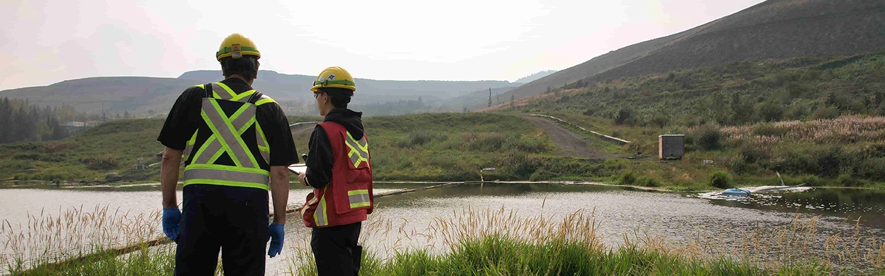
This region is bordered by the Yukon and Northwest Territories in the north, the Rocky Mountains to the west and Alberta to the east. Its location at the intersection of major western Canadian trade corridors positions investors close to the Montney natural gas basin, critical minerals deposits, large-scale forestry operations, and cross border road and air logistics into Alberta, Yukon, Northwest Territories and Alaska.
Affordable housing and a comparatively low cost of living attract and retain a stable, highly mobile community of entrepreneurs, tradespeople, clean energy, and resource professionals.
Regional Advantages
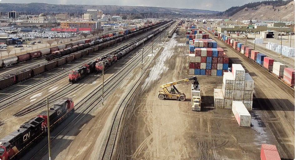
Strategic Alaska Highway & Northern Corridor Logistics Hub
The 2,000km stretch, from Dawson Creek to Alaska, provides a direct surface trade route for critical minerals operations in the northern region of the province, as well as Alberta, the Yukon, Northwest Territories and the state of Alaska. This corridor supports heavy haul, equipment movement, workforce mobility and just‑in‑time supply chains for energy, mining, forestry and construction projects across northern Western Canada and into the U.S. market.
Competitive Cost Base & Talent Retention
Families in Fort St. John have the highest average household income in B.C. and the fifth highest in all of Canada, while housing and everyday living costs remain comparatively lower than major metropolitan centres. This combination of high wages and moderate costs supports workforce attraction and long term retention for industrial employers, particularly in energy, construction, transportation, and trades.

Young, Industrial Workforce In A Regional Service Centre
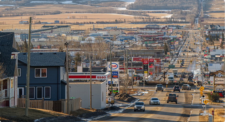
The largest city in B.C. along the Alaska Highway, Fort St. John, is called a regional service and operations hub for oil and gas, clean energy, construction, transportation, and professional services. Its younger than average population, strong participation in trades and technical occupations, and concentration of industrial suppliers make it a strategic base for project management, field operations, and regional headquarters functions.
Applied Innovation & Capital Support For Industrial SMEs
Provides funding for SME’s in eligible industries for applied research and development, new or improved products, and services and testing of innovative technologies. This includes support for companies advancing clean energy solutions, industrial automation, agri tech, and process improvements that enhance productivity and reduce operating costs across the region’s resource and manufacturing sectors.
Key Sectors


Economic Advantages
Fort St. John
Fort St. John is “The Energetic City”, which reflects not only our large resource base of oil, natural gas, forestry and agriculture, but also the vitality of our residents who are keen to live and work in a community that gives back so much. Fort St. John attracts travelers with its wilderness adventures, as well as being home to some of the best hunting and fishing opportunities in North America and is often referred to as “The Serengeti of the North”. Not to mention, people from near and far come to travel the world’s renowned and scenic Alaska Highway.
Dawson Creek
Dawson Creek is located in The Boreal Plains Ecozone. It is part of the flat Interior Plains of Canada, a northern extension of the Great Plains of North America. The Peace Lowland ecoregion is characterized by a unique climate, marked by warmer summers than the surrounding areas. The mean annual temperature is 0.5°C. The mean summer temperature is 13°C and the mean winter temperature is -14°C. The mean annual precipitation ranges from 350–600 mm.
Communities
The Northeast has a population of 72,015 people. Main population centres such as Fort St. John and Dawson Creek and smaller communities such as Chetwynd, Tumbler Ridge, Fort Nelson, Pouce Coupe and Taylor all contribute to the region’s growing natural resource-based economy.
These communities host a network of industrial parks, service yards, transportation depots and project camps that collectively support large‑scale activity in natural gas, critical minerals, forestry, agriculture, clean energy and related supply chains.
Regional Labour Force ProfileEconomic Development Organizations
First Nations
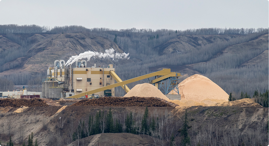
The Northeastern economy is based on natural resources, particularly natural gas production and coal mining. Other important industries include logging, wood products manufacturing and agriculture. Emerging opportunities in clean energy, critical minerals, carbon management and value‑added processing are expanding the regional investment pipeline.
Development corporations— owned collectively by aligned First Nations or by individual First Nations— are the primary vehicles by which First Nations pursue and advocate for sustainable economic development in the region. These entities are active partners in major projects, joint ventures, procurement, workforce development and long‑term infrastructure planning, creating structured pathways for investors to engage in responsible, partnership‑based development.
Learn more about First Nations in BCEconomic Development Organizations
Logistics & Accessibility
Educational Institutions

The University of Northern British Columbia (UNBC) is a research-intensive public university with a campus in Fort St. John.

Northern Lights College empowers and enhances the local workforce through a wide range of professional programs, including business management, oil and gas field operations, and trades.
Connect With a Regional Expert
Regional experts can help familiarize you with the amenities, infrastructure, and opportunities in each region. They can introduce you to the economic development offices and industry associations that will support the integration of your business into the province.